Eisenbahn Trail links constellation of cities and state’s wild(er) places
WISCO 100: This is the fourth in a series of reports on 100 outdoor adventures across Wisconsin, spanning every corner of the state and embracing the broadest possible definition of adventure.
There has never been a morning better than the morning, any morning, when you find yourself hurtling forward through parts of Wisconsin on a bicycle.
Just such a morning as this. It began at 6:30 a.m., three minutes past sunrise, at a trailhead parking lot in West Bend on the southern outskirts of town, an otherwise unexceptional locus between rural and industrial zones. The Eisenbahn State Trail starts here, at Rusco Road, and continues north about 25 miles through Kewaskum and Campbellsport until concluding at an even less exceptional endpoint in the community of Eden. Paved for the first few miles and then mostly hard-packed dirt and gravel, the Eisenbahn is a rail trail, on right of way that formerly accommodated trains. A cyclist can depend on it for a mostly flat and mostly straight ride.
On this morning, I had it in my mind to ride the entire thing. Twice.
Wisconsin has 44 designated state trails, many of them built on former rail beds. Cyclists share them with runners, hikers, walkers, dog walkers, snowmobilers, ATVers, horseback riders, cross-country skiers, in-line skaters, unicyclers, cartwheelers, interpretive dancers, long-distance brooders and any other breed of active Wisconsinite you can imagine — though, of course, not all at the same time or on the same trail. (Check usage restrictions in advance.) Even within the cycling community, there are many reasons to experience a rail trail: the commute, the family ride, the workout, the nature sampler. Alyssa Hallgren, co-owner of Fond du Lac Cyclery, says a rail trail is a great way to get out of your head for a while — or to go in the other direction, deeper into your head, depending on your mood.
A critical benefit: You don’t need to worry as much about a car side-swiping you and landing you first on the ground and then in the hospital. “Any time cars are a factor, the danger increases,” Hallgren told me when I gave her a call to learn more about the local cycling scene. On a rail trail, the cyclist’s thoughts are free to burrow inward or launch outward, feeding on the passing scenery, as you pedal, pedal, pedal.
“There’s a real peacefulness to it,” Hallgren said.
I chose the Eisenbahn State Trail as the fourth adventure in the Wisco 100 series because it was there, because I really wanted to get out on the bike, because I wasn’t quite sure I’d be able to complete the 50-mile out-and-back journey (suspense!) and because this is the kind of adventure that I had in mind when I first set a quixotic goal of completing a hundred outdoor adventures around our state. The full Eisenbahn is not only a personal endurance test but also an opportunity to study and consume the unique, understated beauty of our great state. And though I won’t be writing about all 44 of Wisconsin’s state trails, I hope to experience quite a few of them before I’m done.
I’ve cycled on parts of the Eisenbahn before, though never the full thing. A few times, the trail’s West Bend segment was a pleasant diversion while my sons were warming up for baseball games at the city’s Little League fields. My most significant Eisenbahn outing, five years ago, was a ride up the trail north of Kewaskum with my occasional riding buddies Keith and Bob.
Now, on a chilly but tolerable morning in early April, I rode alone.
“True solitude is found in the wild places, where one is without human obligation,” Wendell Berry, America’s farmer-poet, wrote in the year I was born.
Now some 48 years later, I was eager to escape human obligation for at least one morning. Parking the van at the Eisenbahn trailhead, I was still far from the truly wild places. I hauled my Jamis Aurora bike out of the back and bundled up for the 37-degree dawn.
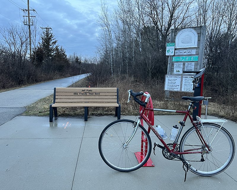
An active rail line dead-ends on the south side of Rusco Road, making it possible for the multiuse trail to begin on the north side. Its parking lot is a newerr addition, built in 2021, and offers 11 parking spaces, a portable toilet and a bike repair station. While the Wisconsin Department of Natural Resources oversees the state trail system and maintains many of its trails, some trails, like the Eisenbahn, are tended by local partnerships. Washington and Fond du Lac counties are jointly responsible for these 25 miles, with support from organizations like Bike Friendly West Bend.
If you didn’t check usage restrictions in advance, you can check them in person, on the trailhead sign. For the West Bend segment of the Eisenbahn, you are allowed to hike, bike, dog-walk, ski and snowshoe. Unauthorized: motorcycles, cars, horses, ATVs — basically anything that might “VROOM!” or “NEIGH!” Having no intention to emit either noise, I felt authorized to start my adventure.
The Eisenbahn begins as a snug corridor shielded by trees and shrubbery, opening occasionally to reveal fields and streams. Elevated above the surrounding terrain, its sides sloping steeply down, the trail transitions quickly into an industrial zone and residential neighborhoods, with views of the backs of warehouses, trailside parks, playgrounds and neighbors back yards. West Bend is a fun cycling town, and the Eisenbahn is a big reason. Within a few miles, the trail reaches downtown, crossing the Milwaukee River on one of the trail’s many wood-plank bridges. It rolls past a historic former railroad depot just south of Washington Street, the city’s primary east-west corridor.

I was able to get up a healthy speed, about 15 mph, on the trail’s blacktop, but by three miles in, my legs already felt on the verge of cramping up. As I approached the intersection at Washington Street, I heard another cyclist gaining on me. Was I really going so slow? This could portend physical struggles ahead.
The speedy cyclist passed on the left and gave an obligatory tip-of-the-helmet. I did the same, then paused and shouted, “Hi, Mark!”
Recognition. It was Mark Ramsey, the owner of West Bend’s Pedal Moraine Cycle & Fitness (a perfect local bike shop name), whom I had met two days before while researching the Eisenbahn Trail. I think he recognized me back. Before he fully eclipsed me, I hollered ahead to ask if he was headed to the Saturday morning coffee club of cyclists he had told me about. He responded in the affirmative, and I wished him well.
“Enjoy your ride!” he hollered back.
Consuming miles, on pavement, dirt and gravel
Ramsey can’t take credit for the name. Pedal Moraine, a play on the Kettle Moraine State Forest and the hills the region is known for, dates to the shop’s former owner. When Ramsey bought the business in 2002, the name stayed.
Ramsey’s store is a modest-sized, stand-alone building with a rectangular footprint. The sales floor is in the front, and repairs are completed in the back behind a high counter. Pedal Moraine is located on a commercial strip of West Bend’s Main Street south of downtown, next to the Omicron Family Restaurant. More importantly, a bike connection to the Eisenbahn State Trail is less than a mile away, in Ziegler Park.
“The Eisenbahn is great because it caters to all capability of riders,” Ramsey told me when I stopped by to chat with him on a lunch break. He also mentioned another regional favorite, the Wild Goose State Trail, which is closer to Alyssa Hallgren up in Fond du Lac.
Ramsey, a West Bend native, loves all kinds of cycling, and he’s in the right place for it. In addition to rail trails, the West Bend area has top-notch mountain bike trails — Ramsey singled out the Glacial Blue Hills park — and some of the best road riding, along the natural roller coasters of the Kettle Moraine region’s scenic routes.
“We have a great network of interconnected old farm roads, because the milk had to get to the dairy,” Ramsey said. “Everything’s paved and everything connects.”
His use of the Eisenbahn tends to be purposeful, as in the winter, when he can roll out his fat tire bike on the snow. In the warmer months, he takes the trail to meet fellow riders, with coffee for the goal, as was the case this Saturday when he passed me.
North of downtown West Bend, the Eisenbahn squeezes between Barton Pond on the left and Lac Lawrann Conservancy on the right. Ducks, geese and mergansers were in no rush as I pedaled by. A bit farther, after the dam and waterfall at Barton Ave., the paved trail turned to dirt near West Bend’s city limits. A long bridge carries the trail back over the Milwaukee River. I wasn’t quite to the wild places, but I was getting closer.
The transition to gravel had noticeably slowed my pace, along with the strengthening headwind. Now I was barely topping 10 mph. Pedal, pedal, pedal. Out of the city, I was nearly the only human on the trail at this early hour, but I had company. American Robins, red-winged blackbirds and dark-eyed juncos were constant companions. A family of sandhill cranes pecked in a dirt field. As I passed by, they began honking. Were they honking at me? Rabbits darted along the path here and there. A young deer seemed intent to out-gallop me, and I was happy to let him win.
As Ramsey had advised me, the segment just north of West Bend is still dominated by the “VROOM!” After passing the bulky steel landmark of West Bend Elevator, the Eisenbahn curves to the right and hugs Highway 45 for about 5 miles, through the other side of Kewaskum, population 4,400. Traffic on that parallel highway won’t side-swipe you, but it won’t leave you at peace either.

The trees hadn’t yet filled in, so long-distance visibility was high. Look west, and that’s Sunburst Ski Area, mostly denuded of snow except a few dirty white patches. Just before the intersection with Highway H, the Eisenbahn intersects with Wisconsin’s most famous and longest trail, now also designated a National Scenic Trail. The Ice Age Trail stretches more than 1,000 miles from the Minnesota state line to Door County. A runner on an eastward IAT jog flashed by me as I slowed briefly to look for the trail’s signature yellow hash marks.
Most people who use rail trails don’t venture much more than a mile or two beyond the center of their communities, according to the DNR, which makes sense. If you live in Kewaskum, the Eisenbahn is an easy go-to route for a short walk, run or ride. Nearly all of the people I saw on my trip were within a couple miles of one of the four communities that make up the trail’s linear constellation. A dog walker here, a young family with a stroller there. Not too many cyclists, but a few.
On the other side of Kewaskum, I was alone again. My fingers and toes were barely maintaining circulation. The warmth of the rising sun had yet to make a dent in the early chill. Anything colder would have been a challenge, but I locked in mentally — pedal, pedal, pedal — while reminding myself to look around at the increasingly wild landscape, the steady miles of agricultural fields and wetlands that make up a mostly unpopulated Wisconsin terrain once bisected by locomotives.
The future of rail trails is on the incline
A train has its limits. It can climb, but only up hills so steep. It can turn, but only around turns so sharp. And in a nation of hills, valleys and and other natural obstacles, that topography can bedevil the railroad designer.
But humans have obligations. Trains need to chug, chug, chug along, so that landscape must be carved and threaded so the trains can get through. Some math can help.
American railroads typically design their tracks so the incline is no more than 1%, or the equivalent of one foot of climb for every 100 feet traveled. And a straight, or “tangent,” track is preferred. Any curves are usually gentle, about 1 or 2 degrees (as in a portion of a circle’s 360 degrees). Curves of up to 20 degrees are possible and may be necessary through mountainous terrain. That’s everything I know about railroad design, all of which I learned from this Trains Magazine article.
And what happens when a railroad dies? More than 25,000 miles of carefully designed railroad beds are now multiuse trails offering outdoor adventure for runners, cyclists, cartwheelers, etc., in more than 2,400 locations nationwide and counting. Wisconsin alone has more than 100 rail trails, both state-owned and local, according to the Rails to Trail Conservancy, founded in 1986 when the movement to create such trails in the United States was chugging away.
The public’s enjoyment of those trails continues to gain steam today.
“The future of trails, not only in the state but in the country is on the rise, big time,” Missy VanLanduyt told me by phone before my Eisenbahn ride. She heads the recreational partnerships section of the Wisconsin DNR’s Bureau of Parks and Recreation Management. VanLanduyt explained that the barriers to enjoy most state trails, especially rail trails, are very low, usually just some hiking boots or running shoes, or in my case a working bicycle. “Many more people, especially since the pandemic, are getting outdoors and on our trails.”
Wisconsin’s 44 state trails span more than 2,000 miles, including one water-based trail, the Lake Michigan State Water Trail. Try biking on that!
Most of the state trails, 39, are built on former rail lines, the oldest being the Elroy-Sparta State Trail in Monroe and Juneau counties. Established in 1965, the Elroy-Sparta, with its signature tunnels and their wooden doors, also is considered to be the nation’s first rail trail. Some trails require the purchase of a state pass, so check in advance.
VanLanduyt noted that the Eisenbahn is one of the shorter trails in the state network. Eighteen other trails are 30 miles or longer, and six are at least 75 miles. Even so, a trail like the Eisenbahn’s is open to a range of uses and connects several communities.
The trail, which takes its name from the German word for “railway,” was built on the former route of the Milwaukee and Fond du Lac Airline, a branch of the Milwaukee and Superior Railroad. The original rail line opened in 1850 and remained an active until its closure in 1999, according to a Rails to Trails Conservancy guidebook. It was redeveloped and reopened as the Eisenbahn State Trail in 2006.

Now, after passing through Campbellsport, population 2,000, and with seven miles left to the Eisenbahn’s northern terminus, I have a confession: I don’t particularly like rail trails.
In our biking trio, Bob is the biggest rail trail fan. He would prefer a dedicated bike path any day over combat with automobiles. Keith is an omnicyclist. On any terrain, in any direction, he is up for the outing, with several bikes to choose from.
For me, rail trails can serve a purpose. If I have some time to kill on my lunch hour, I might hit the Hank Aaron Trail in West Allis to log a few miles. But long-haul rail trail riding just isn’t as interesting as those roller coaster country roads that Ramsey was talking about. I love the twists and turns, the ups and downs, the speed that is only possible on smooth pavement, and yeah, I even kind of love the combat with automobiles (though not literally, please).
Confession over. The Eisenbahn State Trail is still an amazing experience, a great example of what the state’s trail system has to offer.
And oh, the sweetness of a Wisconsin morning! The overnight rain thankfully had not continued into pedaling hours, though shimmering droplets still hung from the dogwood that lined much of the trail. The farm fields at this crisp hour seemed ready to bring forth new life, and water was everywhere, streams, ponds, marshes. Wisconsin has about 6 million acres of wetlands, and for all I knew, I was witness to every one as I pedaled my way to Eden.

The Eisenbahn State Trail’s endpoint/startpoint in Eden. The 25-mile rail trail connects communities in Fond du Lac and Washington counties, with a southern trailhead in West Bend.
Morning trail ride, powered by brat
But in Eden, my straight path ended in confusion. Google Maps had told me the Eisenbahn continued to Main Street. Instead, I was approaching what initially appeared to be a dead end. The only option was a sharp right turn onto an extended, raised boardwalk.
I slowed down and navigated the boardwalk. Not slow enough — BAM, down I went at one corner when my back tire skidded across the mossy planks. Luckily, I had been moving slowly and, though shaken, had only wounded my pride.
The boardwalk ended at the Eden Community Center. Strangely, no sign indicated this was the end of the Eisenbahn. To the west, I found Google’s imaginary endpoint. The trail there had transformed back into an active rail line, where it crossed Main Street. There was no bicycle access here. Don’t trust everything you read online.
Being back on a paved road brought a thrill back to my weary legs. I took a right turn with eager speed and wondered if I had it in me to pedal all the way to Fond du Lac. But at the top of a hill, I stopped, looked down the other side and thought of how difficult it would be to pedal back up. I already was beyond my normal fatigue threshold and still had to finish the 25-mile return trip to West Bend. The right decision was to turn back now.
In Eden, population 900, the Eisenbahn’s proper trailhead is located at the end of a short connector trail, with parking at Eden Community Park. I figured that would be my best way back, but first I stopped at the gas station next to the Eden Cafe and picked up a coffee, which was not very strong but only cost $1.
It was 9 a.m., and outside in the parking lot, the Ruff Riders Snowmobile Club had fired up the grill for its semi-annual Brat Fry. I couldn’t resist handing over $5 and taking a brat from Dan, a man clad in a Ski-Doo riding jacket. Dan told me was the first brat of the day, and the club expected to sell 250 by midafternoon, as well as 250 burgers.

I asked Dan how the past season had been for snowmobiling. Just six days, he said, “and that’s double last year.” Snowmobiling is an authorized use of this end of the Eisenbahn, though another club is responsible for maintaining the state trail in the winter. The Ruff Riders take care of other trails north of the Eisenbahn.
Another club member, Joe, confirmed to me that the Eisenbahn ends before Main Street, where the rail line resumes. With a cigar gripped between his fingers, Joe added that he once had to respond to complaints from irate neighbors after some snowmobilers mistakenly took the boardwalk to the right instead of the connector trail to the left. He assured the neighbors that no one would make that mistake again. (I didn’t let on that I had made that particular mistake myself and paid the price.)
Back in the saddle, I found my way to Eden Community Park and stopped to pose the bike for a photo in front of the Eisenbahn State Trail sign. Another sign, on the trail heading south, indicated the estimated mileage to Rusco Road: 24.6 miles.
Now benefiting from a tailwind and a gradual downward ride back to West Bend, I was feeling a new boost of energy. However wild or solitary, there are no hard miles on a morning like this.